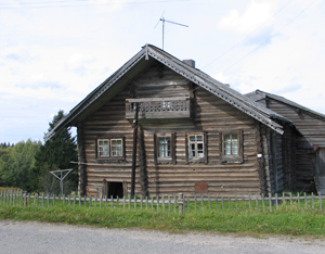
One of the objectives of the project is to generate new approaches for the utilization of spatial potential in the pilot territories. Firstly, the feasibility of using elements of local historical and cultural heritage for the development of the target territories is assessed. Further, a utility network analysis study is conducted to formulate models guiding future action. This will guide constructing scenarios of best practice in spatial planning, taking into consideration also the predictions of climate change scenarios. The best solution fitting local situation of target areas will be chosen in collaboration with stakeholders and beneficiaries taking into consideration local historical and cultural heritage.
Defining the framework of eco-municipalities
Description of eco-municipalities development trends and examples of eco-municipalities in the ENPI territory Review of the Finnish experience in the spatial planning of remote semi-rural regions Results and best practices of Finnish rural development projects, review of scientific and technical literature, interviews of regional authorities and technology providers Assessment of spatial development potential in pilot territories Assessment of present economic use of the pilot territories and mapping of available resources
Utilities network analysis Description of energy network, status of communal infrastructure (water supply and sewage pipelines, wastewater treatment system, sludge treatment), status of road network, mapping plans for extension of public service network; incorporating climate change uncertainties |
 Eco-municipalities publications
Spatial planning best practices
Utilities network analysis
This project is co-funded by the European Union,
|

